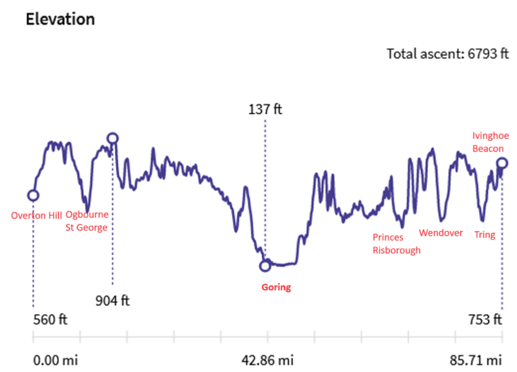
With some help from the Ordance Survey we have measured the total ascent of The Ridgeway National Trail and determined that the entire route involves 6,800 feet of ascent. But the pattern of the hills is far from even, as the following chart shows:
If we split The Ridgeway into two sections (west and east) with Goring and the Thames Valley being the dividing line, then 60% of the ascent is in the second half making it 50% hillier. This is despite the highest point on the route being in the first half at Liddington Castle.
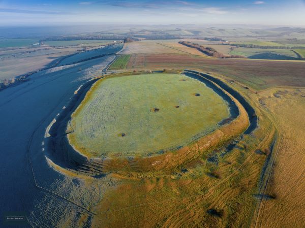
Liddington Castle - the higherst point on The Ridgeway
Lorem ipsum dolor sit amet, consectetur adipiscing elit. Ut elit tellus, luctus nec ullamcorper mattis, pulvinar dapibus leo.
Of course, the challenge of The Ridgeway is that most of the accommodation is not on the route. On the western side, the villages lie on the spring line some 200 feet below. The biggest drop is if you plan to stay at the Greyhound at Letcombe Regis, with a 455 feet climb next morning. So you have to add that on top. The more days you take, the more ascent you add. Our 8 day package, for instance, adds another 900 feet.
The eastern side is not so bad as the Path passes through towns and villages in the valleys: Princes Risborough, Wendover and Tring. And the spring line villages of Watlington, Lewknor and Chinnor are only less than 100 feet below the Trail.
One of the many hills on the Eastern side of The Ridgeway
And, finally, how hilly is The Ridgeway compared to other long distance walks? We’ve ranked a few in order of “hilliness”
South West Coast Path 115,000 feet in 630 miles (182 feet per mile)
Offa’s Dyke 30,000 in 177 miles (169 feet per mile)
Cotswold Way 15,000 feet in 102 miles (147 feet per mile)
Pennine Way 37,000 feet in 270 miles (137 feet per mile)
South Downs Way 13,600 feet in 100 miles (136 feet per mile)
Coast to Coast Walk 20,000 feet in 180 miles (111 feet per mile)
The Ridgeway 7,500 feet in 87 miles (86 feet per mile)
As you can see, The Ridgeway falls at the foot of the hilliness chart. But then we didn’t list the Thames Path!