Ridgeway Distances
Check your Ridgeway distances here.
The Ridgeway is officially 87 miles. But, just like any other long distance footpath, measurements vary. Officially The Ridgeway starts at Overton Hill, a car park frequented by “contemporary pagans” and close to the villages of East and West Kennett. However, there’s no accommodation there. So most people will walk from Avebury up to the next stop of Overton Down (which is higher than Overton Hill!) The distances from Avebury and Overton Hill to Overton Down are about the same.
The terminus of Ivinghoe Beacon is off-road. However, there are a number of choices available at the end of your walk: the National Trust car park, the village of Ivinghoe, Tring station, or Aldbury which has the nearest accommodation.
-
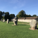 Avebury/Overton Hill 0.0 miles
Although technically not the start of The Ridgeway, Avebury is the logical spot to "start the clock" as it's the nearest village to the official route. It's a remarkable place to start a walk: two sets of stone circles, one inside the other, and a huge ditch were all constructed 5,500 years ago. From Avebury you can walk directly up to Overton Down. Alternatively you can start at the official starting point of Overton Hill which is on the A4 between East and West Kennet.
-
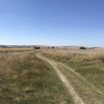 Overton Down 1.6 miles
The path from Avebury joins The Ridgeway at Overton Down. It's 745 feet above sea level. You are now on the Ridge!
-
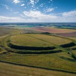 Barbury Castle 6.5 miles
The first of a series of iron age hill forts, dating back to about 500 years BC. The distance here is calculated to the car park at the eastern side of the fort where there is a toilet! Like most iron age hill forts, there's not a lot to see other than the defensive earthworks.
-
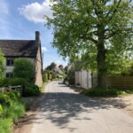 (Road to) Ogbourne St George 8.9 miles
This is the only valley that The Ridgeway passes through until Goring, 40 miles away. Ogbourne St George is named after the River Og. The Path doesn't pass directly through the village but makes a loop around it to the south. So the distance is to the point when you meet the road leading to the centre of the village, a further 0.7 miles away where you will find the literally-named Inn with the Well.
-
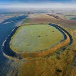 B4192 to Liddington 15.4 miles
Just past Liddington Castle, the second hill fort to be encountered, the path drops sharply to the B4192 which runs from Aldbourne in the south to Liddington, 3/4 of a mile to your north. There's not a lot there: just one B&B accommodation
-
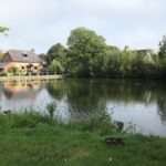 Road to Bishopstone 18.0 miles
At Ridgeway Farm you will cross one of a number of north-south roads that intersect the Ridgeway. This one takes you to Bishopstone, 3/4 of a mile to the north and 200 feet lower. There are few villages as pretty as this which comes equipped with a pond, pub and a shop, the latter two under the ownership of Helen Browning. Look out for her sausages in the local supermarkets.
-
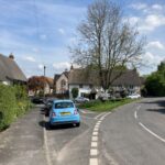 Road to Ashbury 19.6 miles
A feature of The Ridgeway are the villages that lie along the "spring line", where water first emerges from the chalk hills. Ashbury is the next village along from Bishopstone. Although not as pretty as its neighbour,, it's a critical cog in the itinerary as the Rose and Crown is a popular stopover for Ridgeway walkers. Like Bishopstone, it's a 3/4 mile walk downhill and 200 feet lower.
-
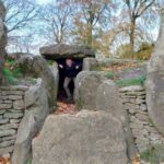 Waylands Smithy 20.2 miles
This is a remarkably preserved "long barrow", a neolithic burial tomb built around 5,500 years ago. It's a two minute walk off the route so not to be missed!
-
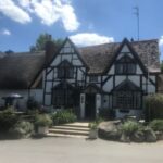 Woolstone Hill 21.4 miles
A track and then a lane take you to the village of Woolstone, the third in the trilogy of spring line villages. This one is home to the White Horse Inn, taking its name from the Uffington White Horse which is just ahead of you.
-
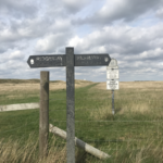 White Horse Hill 21.8 miles
A trig point marks the summit at the lofty height of 261 metres (a little under 900 feet). The trig point sits on the edge of Uffington Castle, the third iron age hill fort along The Ridgeway. And, immediately below the castle, is the White Horse, a huge figure of exposed chalk.
-
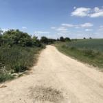 Sparsholt Firs 24.7 miles
Sparsholt Firs marks another critical intersection, this time the B4001 which links the horse training town of Lambourne in the south with Childrey in the north. Here you see the first "gallops", horse training dominating the area. Hill Barn, close to the intersection, offers bed and breakfast and sits opposite the stable of renowned trainer Harry Whittaker.
-
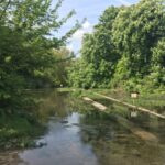 Gramps Hill for Letcombe Basset & Letcombe Regis 26.7 miles
The next intersection is Gramps Hill which takes you down to the village of Letcome Bassett and its slightly larger neighbour, Letcombe Regis. There's no accommodation at Bassett but you will find the Greyhound at Regis. Letcombe Brook is a beautiful chalk stream starting in Letcombe Bassett and flowing north to Letcombe Regis and beyond, past Wantage. The brook is home to protected species such as white-clawed crayfish and water volesIf staying at the Greyhound you will follow this beautiful brook.
-
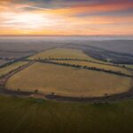 Segsbury Castle 27.6 miles
Last in a line of four hill forts (Barbury, Lididngton, Uffington and Segsbury)
-
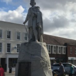 A338 for Wantage 28.2 miles
Being an "A" road, this is one of the busier intersections and care should be taken crossing as it involves a brief road walk as the path does not quite join up here. The town of Wantage, birthplace of King Alfred, lies 2.25 miles below you to the north.
-
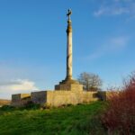 B4494 for Wantage 29.9 miles
The B4494 runs from Wantage to the north down to Newbury to the south. A short walk further along (just under a half mile) will take you to the Lord Wantage Memorial, an obelisk dedicated to those fallen in the Crimean War. Lord Wantage was a founder member of what was to become the British Red Cross.
-
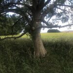 East Hendred Down 32.6 miles
A single track road leads up from East Hendred and terminates at The Ridgeway providing a small car park. Just before the road is Scutchamer Knob, also known as Cuckhamsley Hill. Aside from the views, and possibly some welcome shade, there is a lovely tree dedicated to an unknown Richard.
-
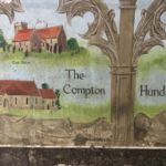 A34 underpass 34.8 miles
There's no access to the A34 which feels more like a motorway than a road. But the underpass itself is decorated with murals dedicated to local history.
-
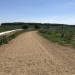 Path to East Ilsley 35.8 miles
The best way to East Ilsley, which lies to your south, is almost exactly a mile from the A34 underpass. It's a lovely 1.2 mile walk alongside a gallop which takes you to the outskirts of the village where two inns, The Swan and The Crown & Horns, welcome you.
-
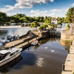 Goring & Streatley 42.4 miles
It may come as a shock to the system to find that the ridge finally comes to an end, having been uninterrupted for the last 33 miles since Ogbourne St George. But this is the famous Goring Gap, the mighty Thames separating the Berkshire Downs from the Chilterns. The town itself comprises has shops, restaurants and three inns/hotels as well as a train station. It would be a good place to stop if it were not for the fact that many will have arrived here from East Ilsley, just 8 miles away. So maybe a late lunch? You're about half way!
-
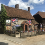 South Stoke 44.3 miles
South Stoke is a delightful Thames-side village with thatched cottages, a church and an inn, the Perch and Pike. It's one of the reasons why The Ridgeway offers a better route along the Thames than the Thames Path which is on the opposite side of the river.
-
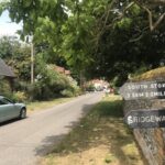 North Stoke 46.8 miles
Lack of a pub makes this village a little less attractive than its neighbour, South Stoke. But it's still a lovely place.
-
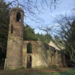 A4130 to Wallingford 48.0 miles
Just past Mongewell, the path, which has been heading north since Goring, takes a sharp right to head east, parallel to the A4130. If you turn left, you can cross the river and follow the Thames Path to Wallingford where you will find shops, restaurants, accommodation and buses.
-
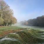 Nuffield 51.8 miles
Nuffield is a small hamlet which once had a pub, The Crown, which is now a coffee shop. It is home to Nuffield Place, once the property of Sir William Morris, the motor manufacturer, and now a National Trust property. At Nuffield, The Ridgeway crosses Huntercombe Golf Course. Nuffield even has its own prison, tucked away behind fields. Its most famous inmate was Boris Becker.
-
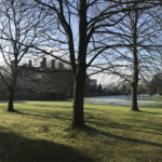 Road to Ewelme 54.3 miles
The lane that connects Ewelme to the west with Cookley Green to the east is crossed here. It is just past Swyncombe House, which The Ridgeway passes behind so you may not even realise you passed it. What is more obvious is the parish church of St Botolph.
-
 White Mark Farm, Watlington 57.4 miles
The Ridgeway is now on a dead straight section along the base of the Chilterns, just above the spring line. All the villages are to your left, some of which offer accommodation. Watlington is the first of these villages, 0.6 miles away.
-
 Road to Lewknor 59.8 miles
Shortly before passing under the M40, aA quiet road leads to the village of Lewknor, half a mile away. There's a pub here. The hotel is best reached from the next road.
-
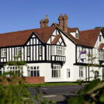 A40 to Thame Lambert Hotel 60.5 miles
The Thame Lambert Hotel is a critical stopover for Ridgeway walkers. Although in Lewknor, it's most directly reached from here being just under a half mile walk. The A40 is not as busy as its name suggests!
-
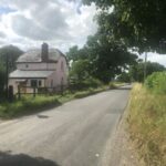 Road to Kingston Blount 61.6 miles
A mile up from the A40 is another road that leads down to Kingston Blount, just over half a mile away. There's not much there aside from the Cherry Tree which serves as a bed and breakfast and coffee shop. Unfortunately no evening meals.
-
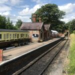 Road to Chinnor 63.1 miles
Chinnor is the next village along but has no accommodation. It's a short half mile walk into the village. Don't be fooled by the sign on the Ordnance Survey map of a railway station. This is the Chinnor & Princes Risborough Railway, a heritage railway running intermittently.
-
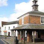 Princes Risborough 68.5 miles
The Ridgeway skirts the back of the town of Princes Risborough, gramatically misspelled as it belonged to Edward, the Black Prince. The town, which has almost every facility you need except a hotel, is best accessed when the path crosses Brimmer Road, half a mile after leaving the A4010. The town centre is just a 1/4 mile from the path.
-
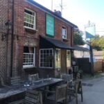 Lower Cadsden 70.1 miles
On leaving Princes Risborough, the path rises steeply and about 300 feet, past Whiteleaf Cross only to descend equally steeply to Lower Cadsden. There's nothing here other than an important inn. Important for two reasons: it's the local for the Prime Minister when residing in the country; and it offers rooms.
-
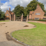 Chequers 71.5 miles
We mentioned that the Plough at Cadsden was the Prime Minister's local. Here's why. The Ridgeway actually crosses through the grounds of Chequers, their country seat. It actually crosses the private drive, the gatehouse being a short distance to your right. It's remarkable that rights of way can be preserved even in the most prestigious surroundings. But be careful not to stray from the path as that is a criminal offence!
-
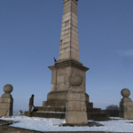 Coombe Hill Monument 73.1 miles
Following another steep 200 foot climb, you will arrive at the monument on the top of Coombe Hill. This was built to commemorate Buckinghamshire's fallen during the Second Boer War.
-
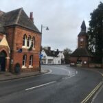 Wendover 74.7 miles
The market town of Wendover is the last settlement that the Ridgeway passes through. It has pubs, restaurants and Bel and the Dragon which offers rooms
-
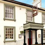 Wiggington 80.8 miles
The Ridgeway passes the outskirts of the small village of Wiggington which sits up on a hill at a height of around 700 feet. The Greyhound, which offers rooms but no breakfast, and community cafe (which offers breakfast!) are about a half a mile away.
-
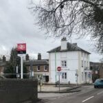 Tring Station 82.6 miles
The town of Tring is nearly 2 miles from its station so Tring Station is a place of its own right. Whilst Tring lies to your left, Aldbury is just under a mile to your right where you can find rooms at the Greyhound (a different Greyhound to that of Wiggington). Beware as the road is busy and there's no pavement! Trains from Tring run into London at frequent intervals so you may well find yourselves back here after completing your walk.
-
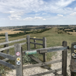 Ivinghoe Beacon 85.9 miles
Well we made it. And we seem to be a mile short! Ivinghoe Beacon marks the end of the trail. At 757 feet it commands glorious views over the Vale of Aylesbury. It is also the site of an iron age hill fort. But you've probably seen enough of those by now and are desperate for the pub. The village of Ivinghoe lies at your feet. It has a pub but no accommodation. You can walk back to Tring station and catch a train to London. Or you could so the civilised thing and walk 3.5 miles via a different route to the Greyhound at Aldbury. Mind how you go!