
Kennet & Avon Canal Walk - 9 days
9 days walking/10 night package
This “superior” itinerary uses a mix of higher grade accommodation. A slightly cheaper alternative (“standard” option) is found at the foot of this page.
Average daily distance 11.2 miles Longest day 14.7 miles (can be reduced to 12.5 miles by taking the Froxfield alternative)
Itinerary
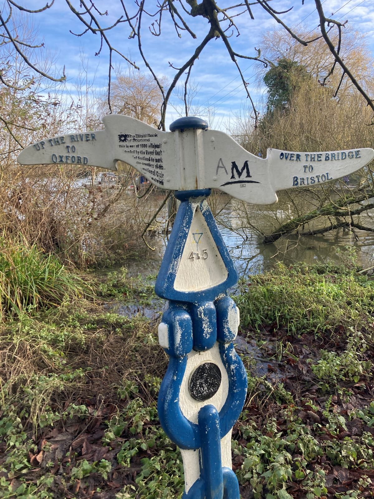
Day 0 Arrive at Reading 2.0 miles
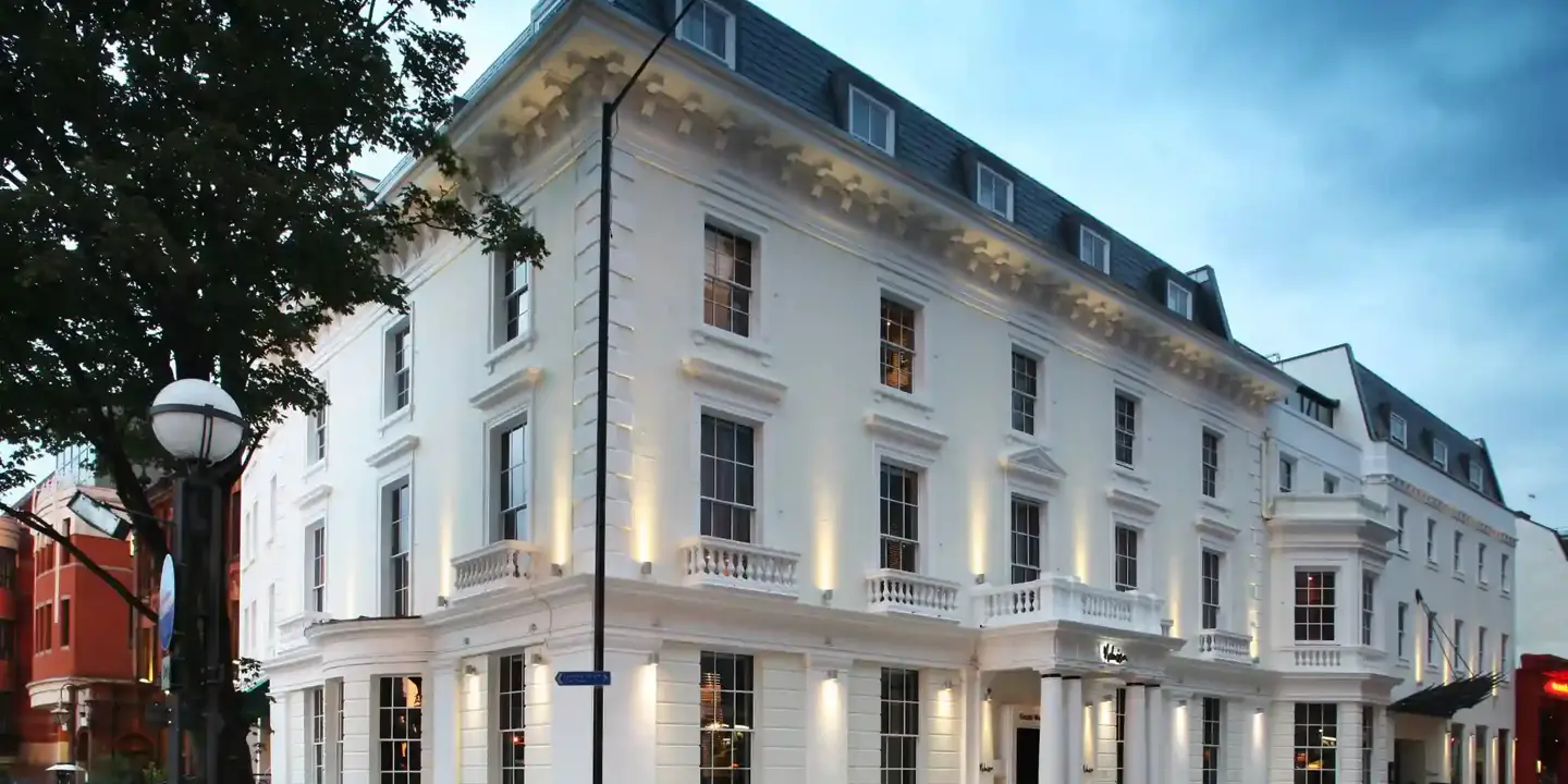
Reading is the largest town in England. It’s also a convenient place to start a walk as there are frequent trains from London, Bristol, Birmingham and Manchester. You will stay at Malmaison, a stone’s throw from the railway station.
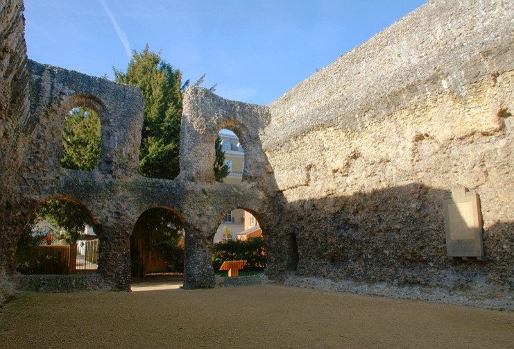
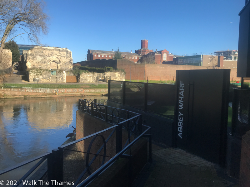
Hopefully you will have time to explore a little of the old town which lies on the opposite side of the canal. The ruins of Reading Abbey can be found here. Once one of the most important abbeys in England, it frequently hosted the king and parliament. Henry I is believed to be buried here. It also marks the start of the St James’ Way, a 67 mile walk to Southampton. It forms part of the Camino Ingles, terminating at Santiago de Compostela. You will share the same path for the first few miles tomorrow. Next to the abbey is the former Reading Gaol which once housed Oscar Wilde. There is a mural on its walls of Oscar Wilde escaping with a typewriter. It was painted by Banksy.
You might also steal a march on tomorrow’s route by walking the mile down to the end of the canal to the confluence of the Kennet and the Thames. Our distances for tomorrow assume you will have done this!
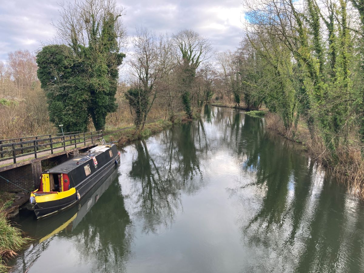
Day 1 Reading to Aldermaston 11.5 miles
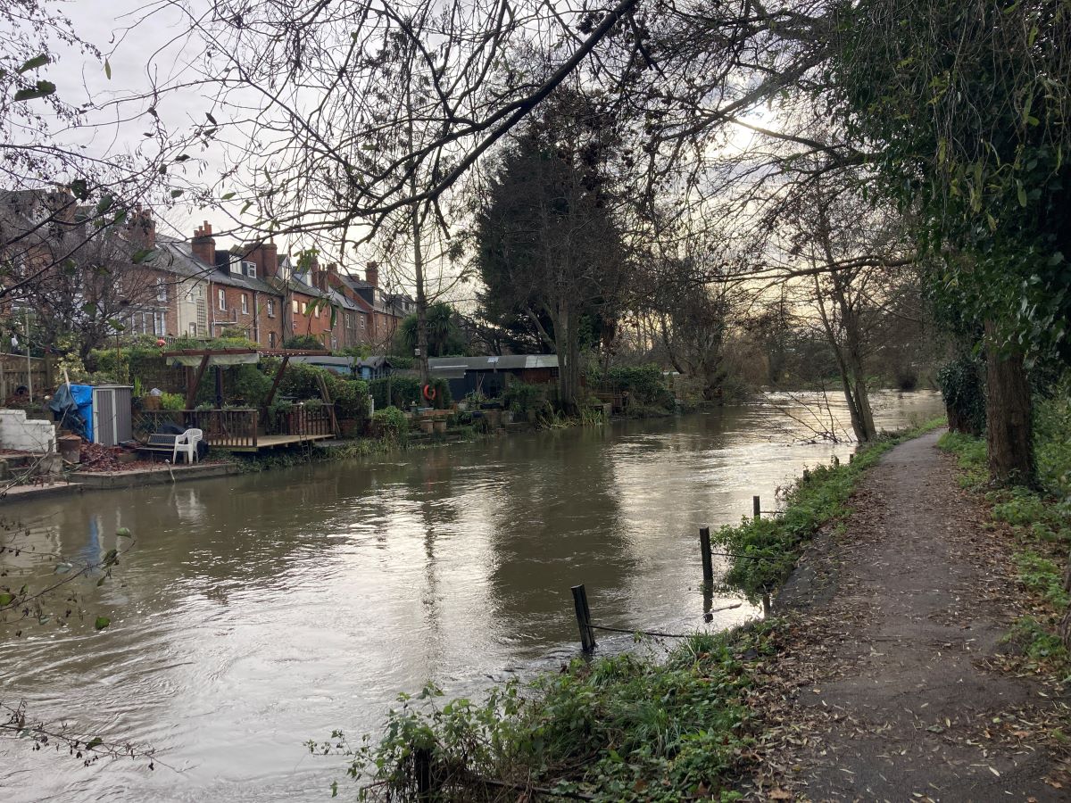
You rejoin the Canal at the Oracle shopping centre with restaurants on either side. Soon out of the centre, the only evidence of the town are the gardens of Victorian terraced houses backing onto the canal on the other side. The canal runs south towards the M4. Warehouses can be seen through the trees.
You will soon be in solitude and, aside from the distant rumble of the M4, the only sounds you will hear will be those of the many birds that are attracted to the canal.
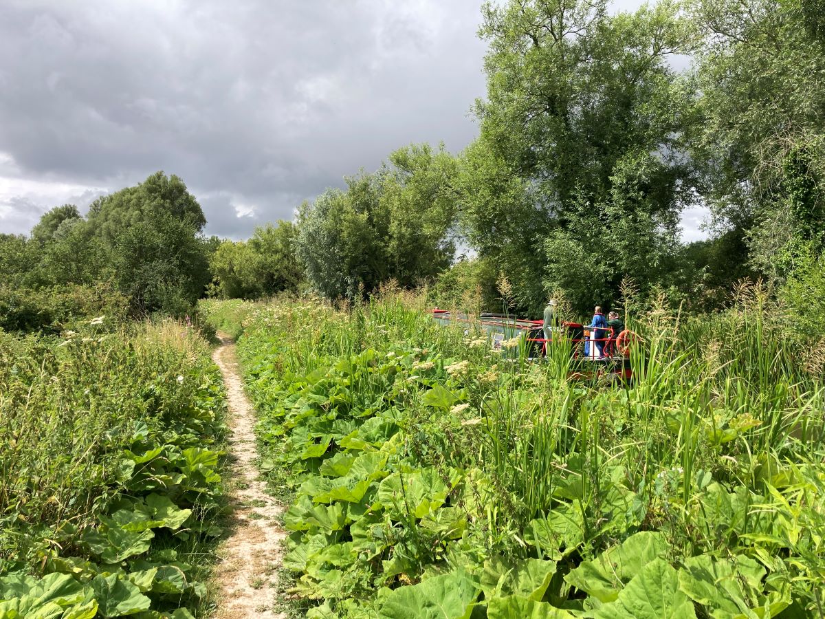
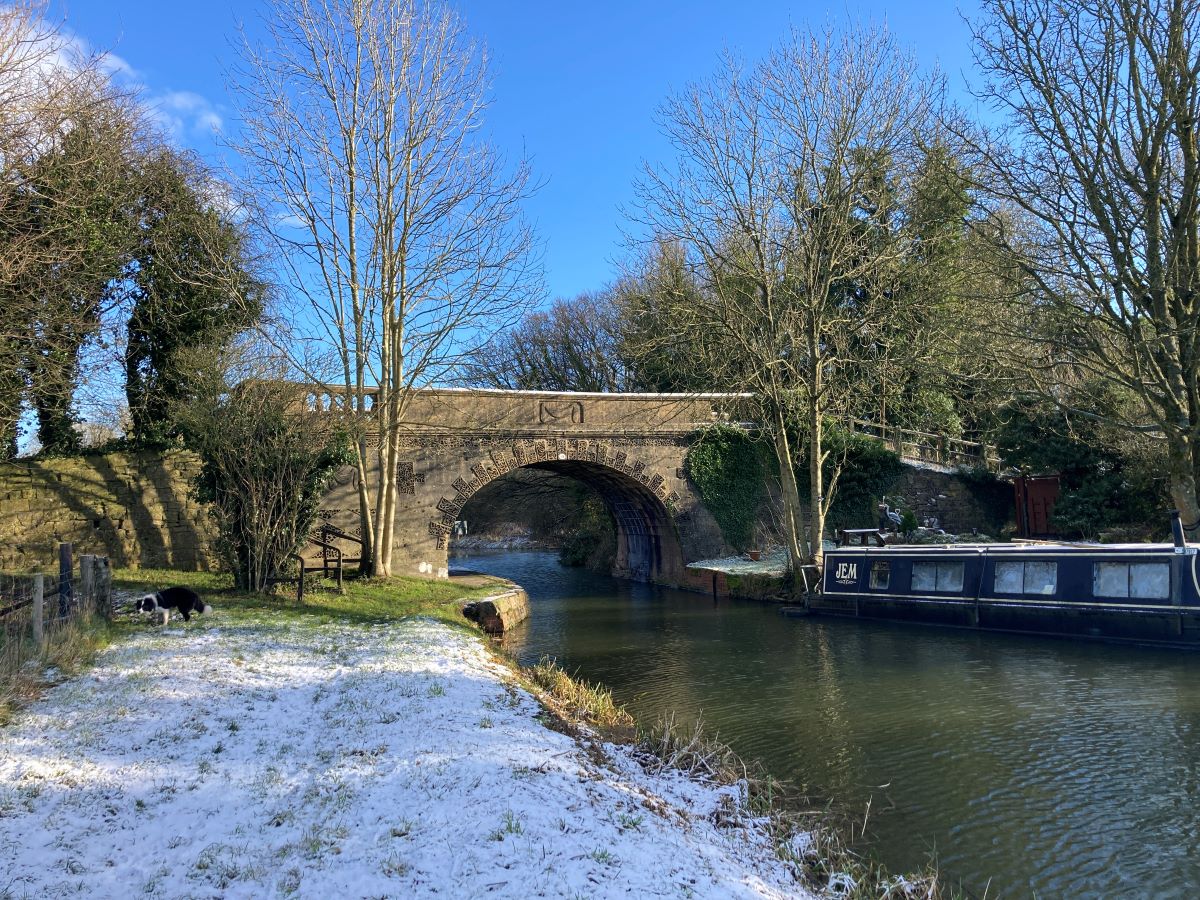
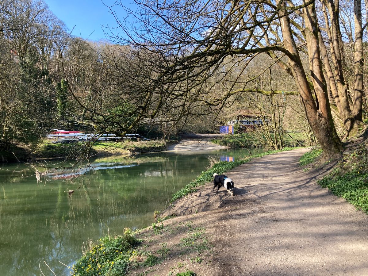
At Fobney Lock, the canal turns sharply west and you might feel relieved that you are now heading in the direction of Bristol. On your left is Fobney Island Nature Reserve, a coming together of marshland, hay and wildflower meadows and reed beds. It is a haven for birds, bats, reptiles and insects.
The rest of the way the canal follows both the Great Western Railway and the A4, three editions of the Great West Way running in parallel. There’s never a dull moment as, every mile or so, you encounter a swing bridge or a lock.
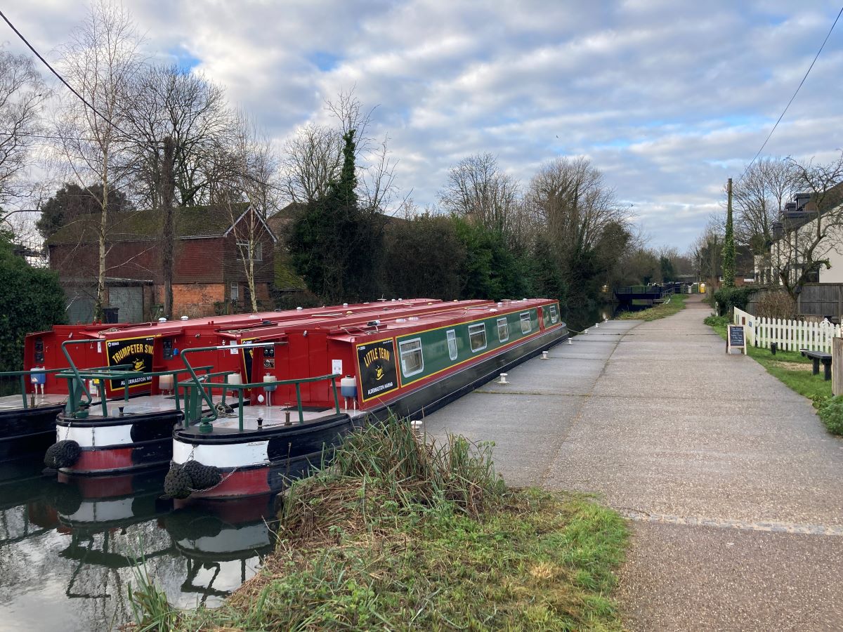
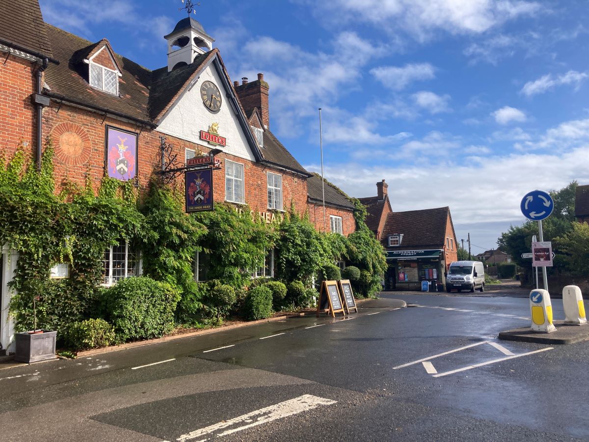
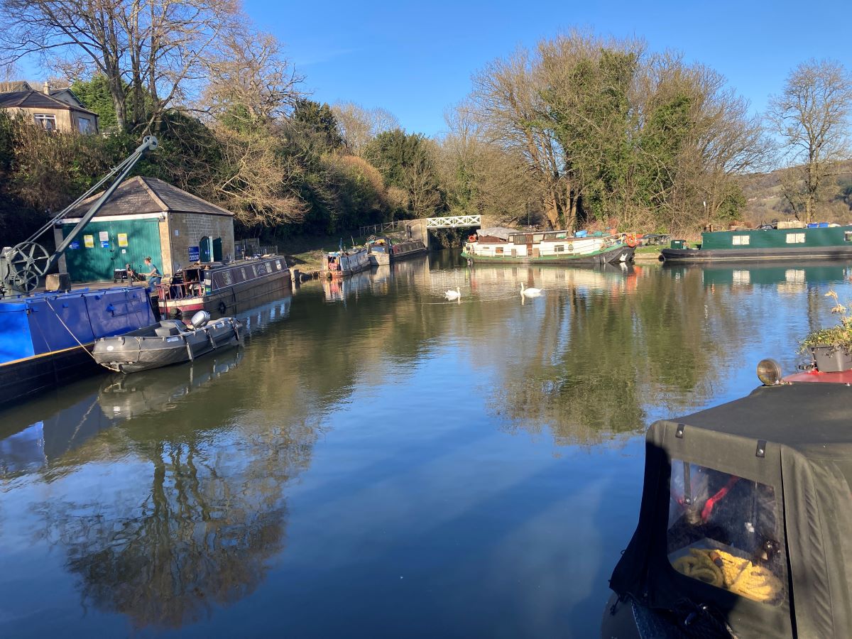
After almost eleven miles you reach Aldermaston Wharf, a busy place as it’s a base for a narrowboat holiday business. There’s a small visitors’ centre here with a welcoming tea shop. It’s a short 1.8 mile walk through fields and across a series of weirs to the village of Aldermaston and the Hinds Head, a popular pub with rooms above. Aldermaston is famous for the anti-nuclear marches of the 1960’s with the Atomic Weapons Establishment housed on a hill high above the village. You won’t have to return The same way tomorrow as you’ll rejoin the canal further along.
Day 2 Aldermaston to Newbury 9.0 miles
Instead of walking back the way you came yesterday, you will use footpaths to rejoin the canal a mile from where you left it. The canal meanders past the villages of Woolhampton and Midgham through dense forests. It’s one of the loveliest stretches of the canal. The Row Barge at Woolhampton will be a welcome stop for coffee.
The town of Thatcham soon appears with a large number of warehouses across the canal. Don’t be surprised if you see a Harrod’s van. They have a state-of-the-art distribution centre here. The town centre is a little further along the canal which, at just over halfway, makes an excellent lunch stop. You’ll find The Swan lies close to the canal.
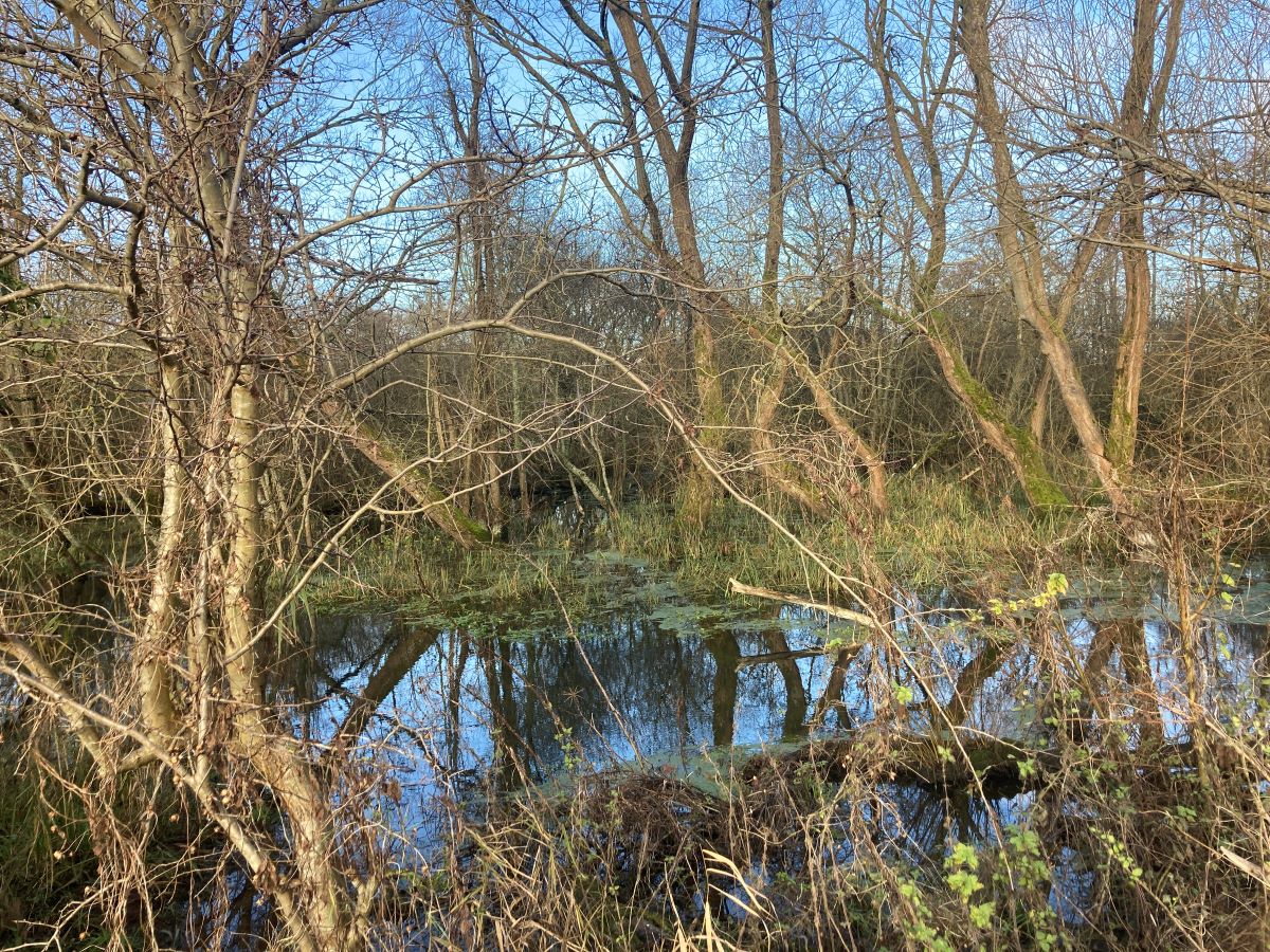
On leaving Thatcham you see Monkey Marsh Lock, one of only two turf-sided locks on the canal. Between Thatcham and Newbury the canal passes through an area of reedbeds. Time permitting you can detour to visit the Nature Discovery Centre.
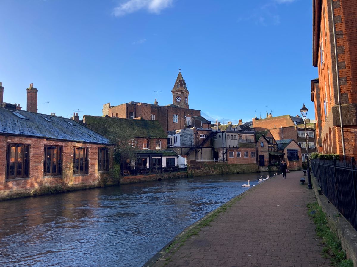
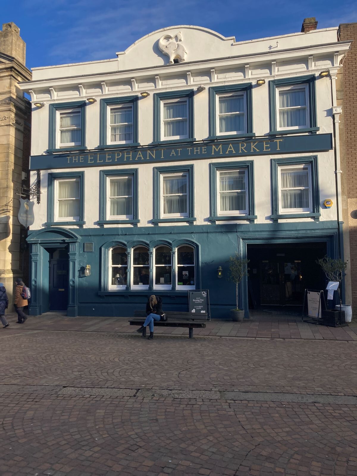
You will soon be in Newbury, your destination for the evening. Newbury is a market town with a famous racecourse which you passed but it was out of view. The market square is dominated by the Corn Exchange, now a cultural venue. The ancient cloth hall now partly houses the West Berkshire Museum. You will stay at the Elephant at the Market which, true to its name, is conveniently located in the market square.
Day 3 Newbury to Hungerford 8.7 miles (or Froxfield 10.9 miles)
You are soon out of the town of Newbury and into similar countryside as yesterday, passing bridges, locks and the remains of the Lambourn Valley Railway which once crossed the canal. You can see the abutments of the bridge. The railway is a constant companion whilst the A4 is some miles to the north. After passing underneath the busy A34 you will observe that the river and the canal intertwine, the river feeding the canal and the canal discharging excess water into the river.
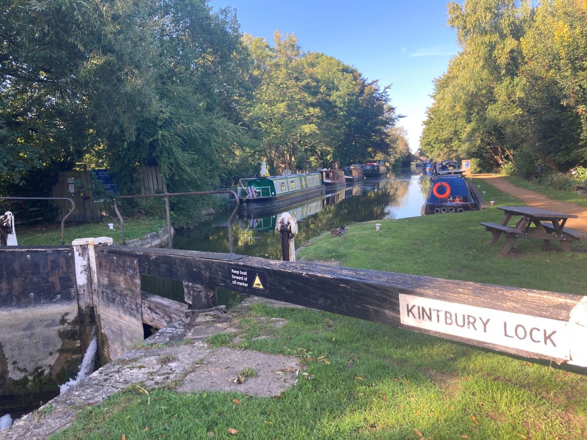
Past Marsh Benham is the village of Kintbury. At 5.5 miles, this is a convenient place for lunch with the Dundas Arms being next to the river. Just past Kintbury is a bridge with a piece of railway track attached to it. These are improvised fixings to stop the bricks separating. On the far side of the bridge you will see how the tow ropes have eroded part of the stone work.
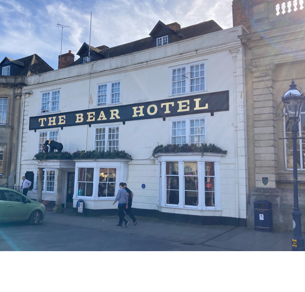
After passing Dunmill Lock you will reach the town of Hungerford. Hungerford is a small town with a number of shops, cafes and restaurants as well as the historic Bear where William of Orange was offered the Crown of England in 1688 during the “Glorious Revolution”.
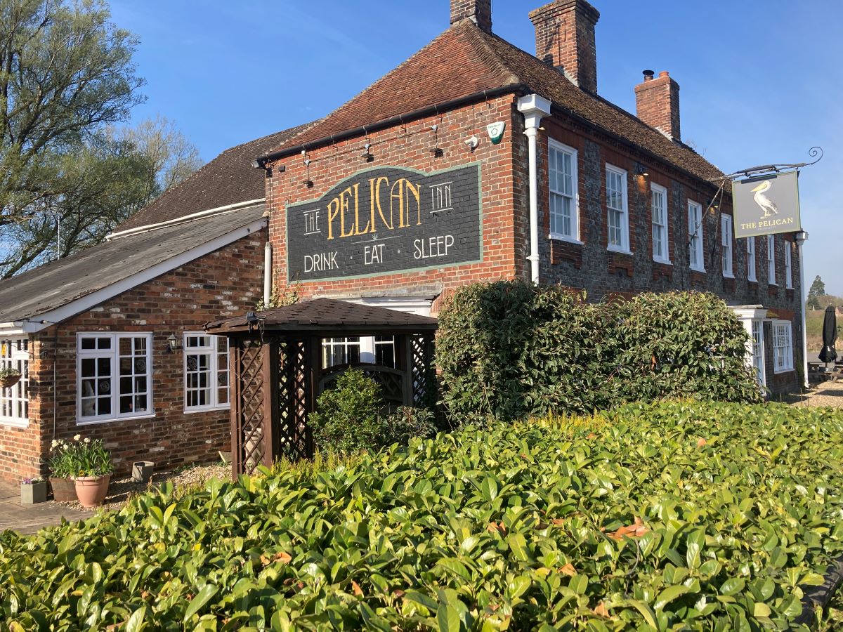
Here you have a choice. Either you stop in Hungerford, staying at The Bear, which will mean your walk tomorrow to Pewsey will be 14.7 miles. Or you walk another 2.2 miles to the Pelican Inn at Froxfield which will reduce your walk tomorrow to 12.5 miles. From a distance perspective, Froxfield is clearly a better option. However, the Pelican Inn does not serve breakfast and there are no cafes nearby. So we will drop a “continental” breakfast pack for you. You can choose which option on the booking form.
Day 4 Hungerford to Pewsey 14.7 miles (12.5 miles from Froxfield)
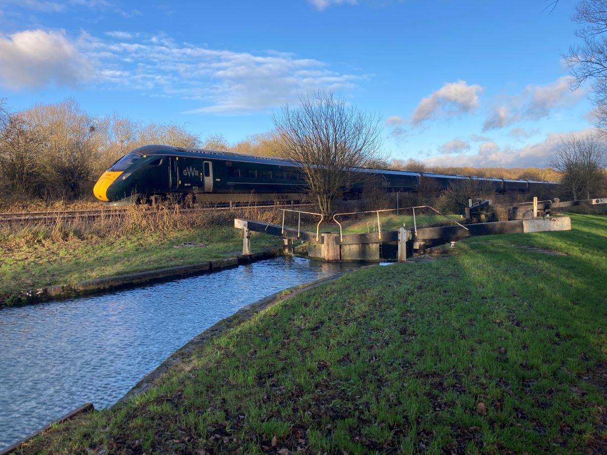
As you leave Hungerford you’ll pass the magnificent church of St Lawrence, unusual in that the church is a good ¼ mile from the High Street. You are no longer following the Kennet River. Hungerford sits on the confluence of the Kennet and the Dun, the Kennet coming in from the north west having originated near Avebury at the start of The Ridgeway. We follow the Dun in a south-westerly direction towards Great Bedwyn, the railway hugging the canal along the way.
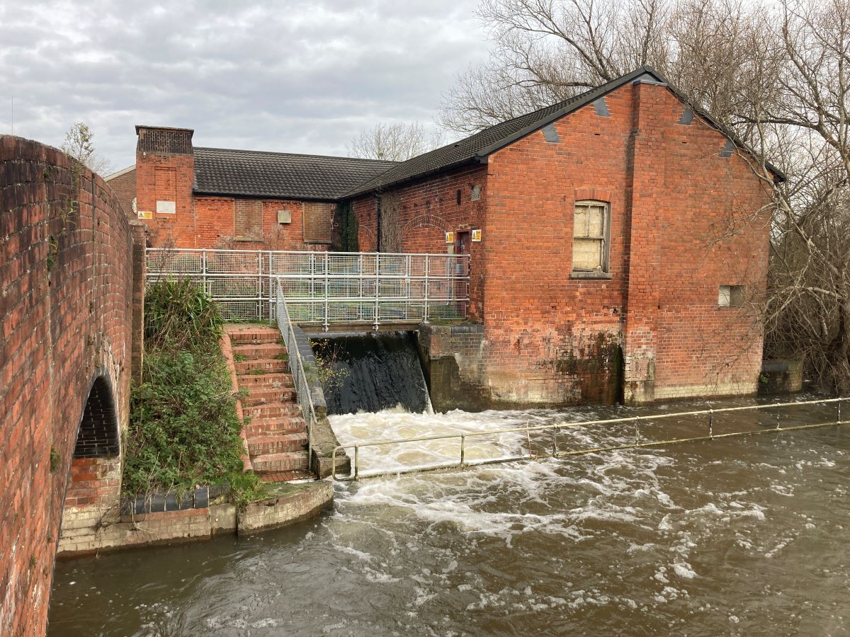
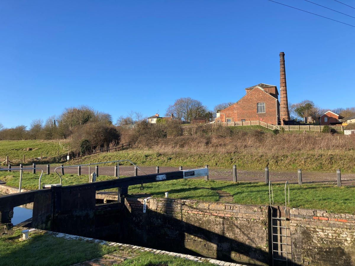
Great Bedwyn, a small village with a mainline station, is also the source of the River Dun. Which means that, from now on, the canal has nothing to feed it. At Crofton, water is pumped out of nearby Wilton Water. The pump used to be operated by steam-driven beam engines which can still be visited.
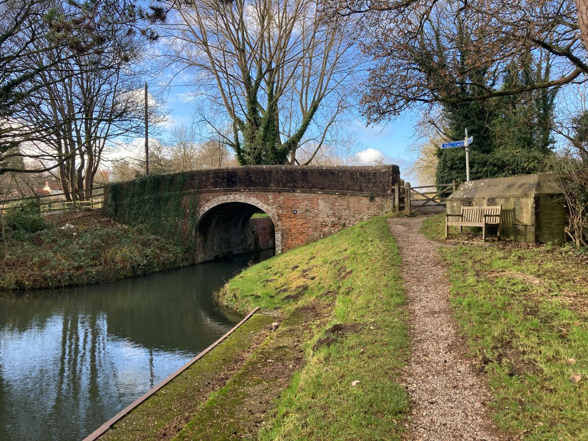
A little on from Crofton is Wolf Hall Bridge, named after nearby Wolf Hall, home of the Seymour family who briefly gave us a queen. Sadly, there’s nothing left of the hall. A mile further and you reach the summit of the walk at Bruce Tunnel, the only tunnel on the canal. This is the first time for you to be separated from the canal. It’s only for a ¼ mile! The path is well marked.
It’s downhill now all the way to Bristol. You will pass Burbage Wharf. The crane is a replica. And on your left is Jones Mill Nature Reserve, wetlands filled in spring and summer with irises and orchids. Just past the reserve you will take a footpath into Pewsey. On the way you will see the infant Avon River.
Your home for the night will be at a bed and breakfast in the heart of the village of Pewsey. It’s convenient for restaurants and pubs where you can take an evening meal.
Day 5 Pewsey to Devizes 12.6 miles
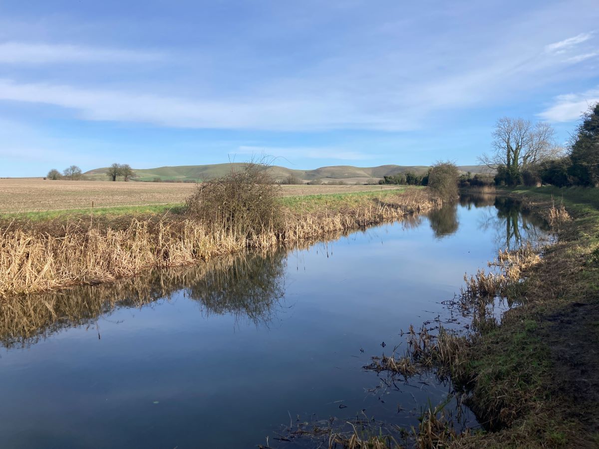
This is the most remote section of the canal as it winds its way through the open countryside of Wiltshire. It’s also, unusually, a day without locks. Between Wootton Rivers, which you passed yesterday approaching Pewsey, and Devizes, there are no locks – a “pound” stretching for 15 miles.
Ladies Bridge is the first highlight. This beautiful bridge is unlike the simple brick bridges as, when the canal was built, the landowner, Lady Susannah Wroughton, insisted on a bridge befitting a Lady. The canal contours the slopes of Picked Hill and Woodborough Hill, part of the Marlborough Downs.
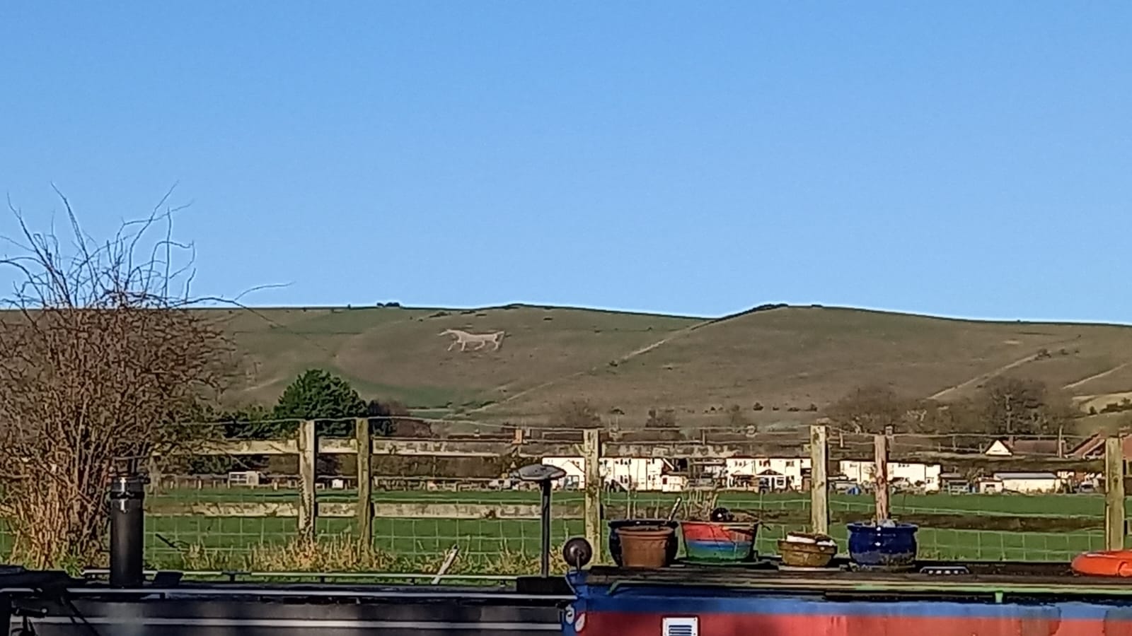
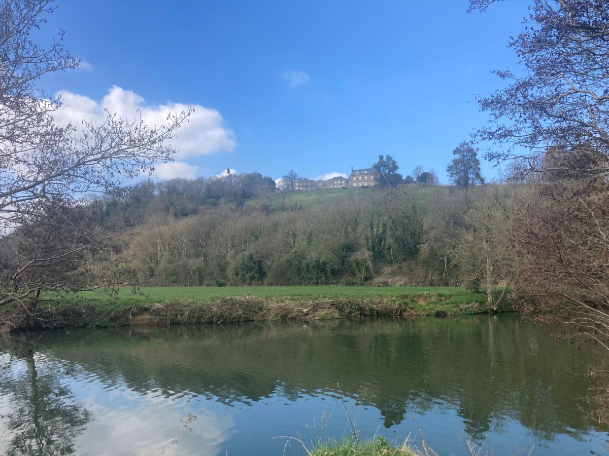
As you approach Honeystreet, a rambling collection of former industrial buildings comprising a saw mill and barge maker, you will see the White Horse of Alton Barnes on the hill to your right. The figure was cut into the chalk in 1812.
At Honeystreet, home to a fabulous café and also the Barge Inn, you will find the Crop Circle Vistors’ Centre. The fields of Wiltshire are world famous for this peculiar phenomenon. Here you can read about their different theories and also how they have affected farm life.
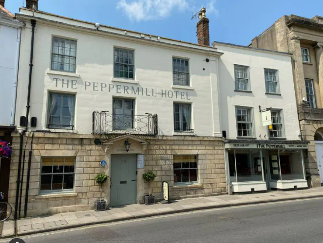
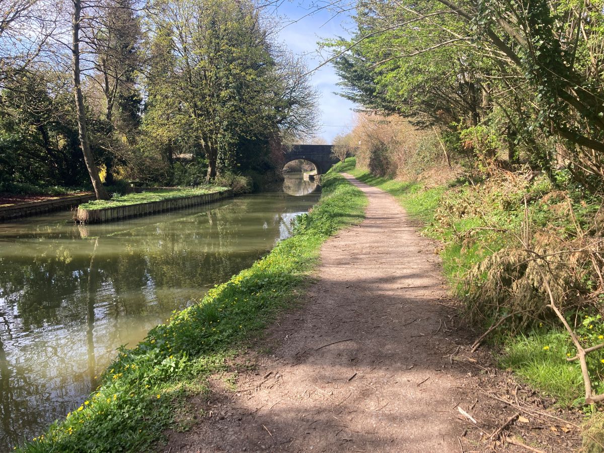
From Honeystreet to Devizes, the canal meanders around the village of Horton. It’s a lonely section, peppered with bridges, and your only company might be fishermen. Devizes is soon reached, the first town since Hungerford. Its rather peculiar name derives from its castle’s Latin name, Castrum ad divisas, meaning the castle at the boundaries. The castle was since replaced. You will stay at the Peppermill, a boutique hotel close to the town square.
Day 6 Devizes to Bradford on Avon 13.0 miles
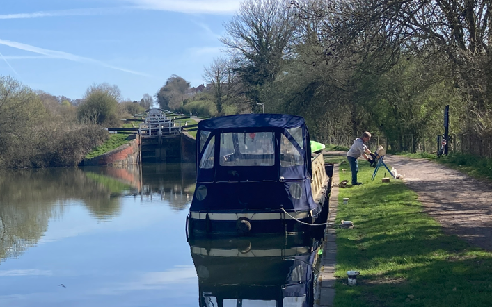
Today is a longish stretch with the most exciting moments being at the beginning and at the end. It starts with the dramatic descent down Caen Hill, a flight of 29 locks covering a drop of 237 feet. Take a moment to watch the boats coming through. Unaided it can take four hours to pass by; although, with the help of volunteers from the Canal & River Trust the time can be halved. As you will be walking downhill it will be a matter of minutes!
At the foot of the staircase you will find a firm and wide path all the way to Bradford on Avon with minimal interruption aside from livestock in the adjoining fields (we’re in pig country here!) and birdlife.
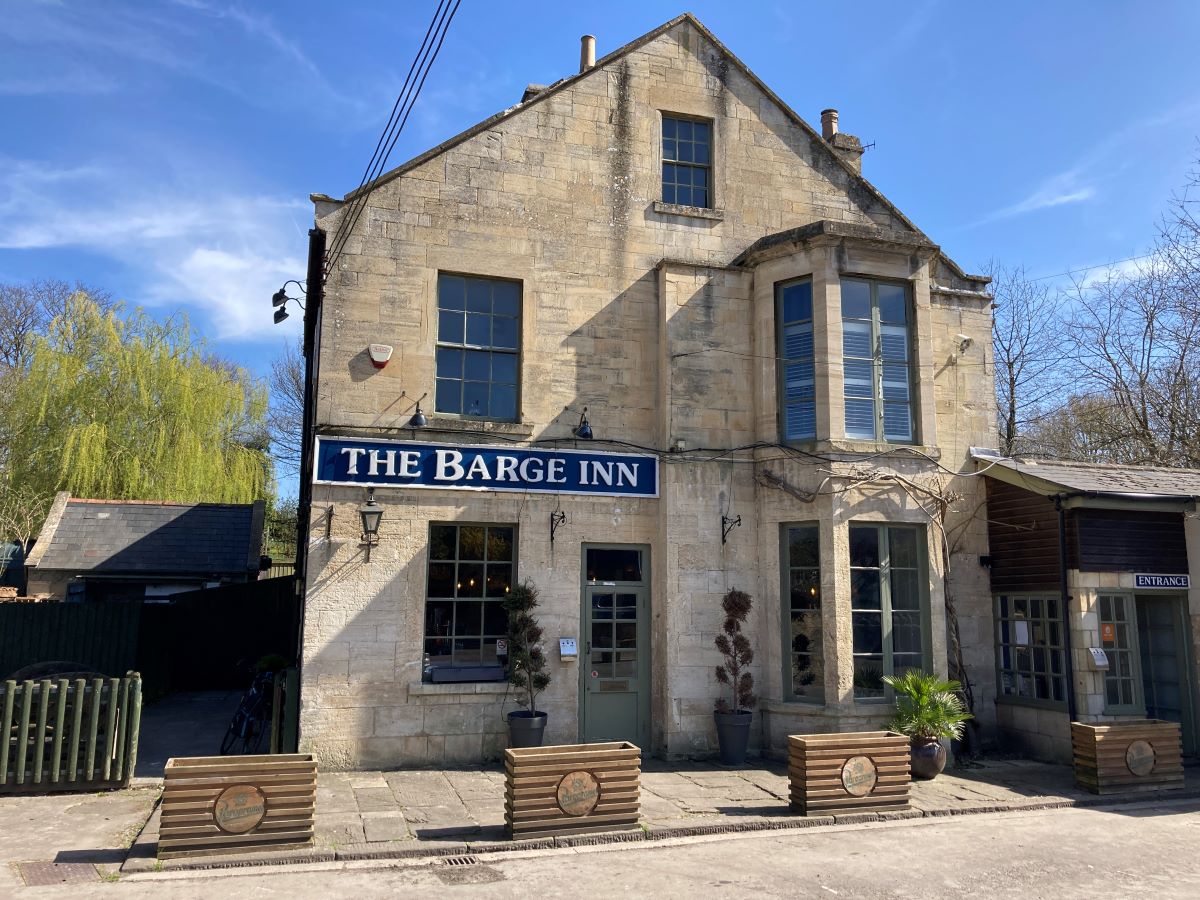
The Barge Inn at Seend Cleeve might be a stop for an early lunch. The towns of Melksham and Trowbridge are represented as signposts on bridges. The start (or finish) of the redundant Wilts and Berks Canal can be seen at Semington, a 52 mile canal stretching to Abingdon on the Thames.
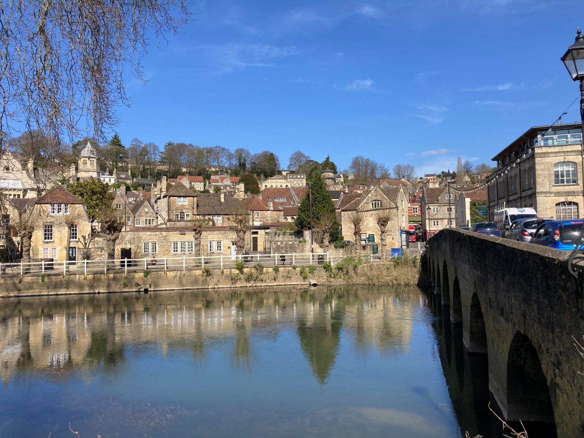
We mentioned earlier that the highlights of the walk were at the beginning and the end. Bradford on Avon, originally Broad Ford, is a former mill town where textiles were produced using local wool powered by the Avon whom we have now rejoined. Here, the railway, the canal and the river are uniquely juxta positioned providing dramatic landscapes. You will be staying at Timbrell’s Yard, a boutique hotel nestling on the banks of the Avon.
Day 7 Bradford on Avon to Bath 9.7 miles
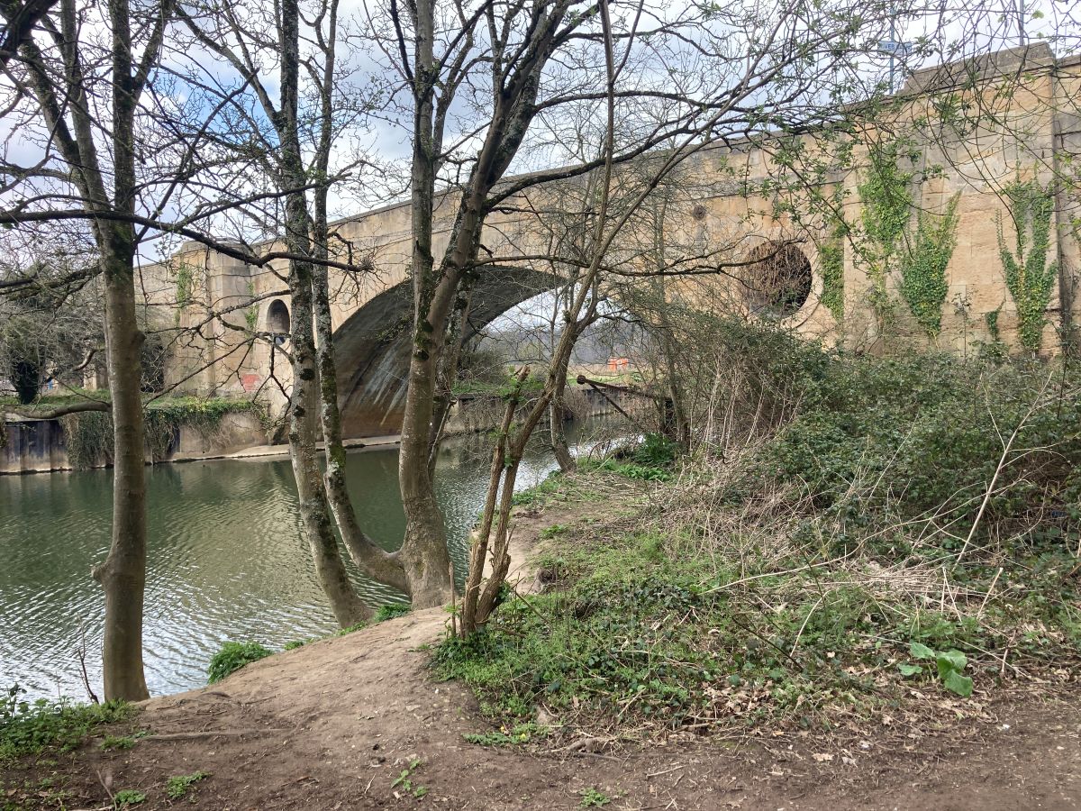
On leaving Bradford-on-Avon the path runs parallel to and above the river. You’ve barely started when you meet the dramatic aqueduct of Avoncliff where the canal makes a sharp 90 degree turn to cross the river and the railway. It was built by John Rennie who also built the previous London Bridge.
You are now on the edges of the Cotswolds: the countryside feels softer with smaller enclosed fields, more woods, and lots of sheep. Pretty villages such as Freshford and Limpley Stoke, adorned with stone cottages, line the steep hillsides.
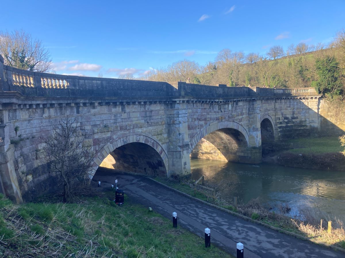
Four miles into the walk the canal hits another aqueduct. This is Dundas where the canal once again dramatically crosses the river and the railway. It also marks the junction of the Somerset Canal, built, as the name suggests, to transport freshly-mined coal from north Somerset to the markets of Bath and Bristol. Only the first 500m remain open.
A little beyond Dundas is the Claverton Pumping Station, another of John Rennie’s structures, steam-driven pumps taking water from the Avon River 40 feet below to keep the canal full. This being supplemented by the streams running off the hills to your left.
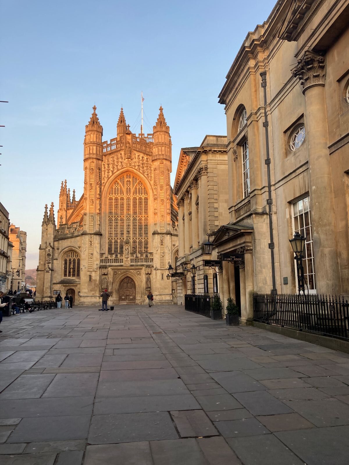
You are soon in Bath, the canal following a highline to the south of the city with views across the rooftops. Bath Abbey can be seen less than a mile away. This famous city, a World Heritage Site, became a popular Roman town on account of its hot springs. It fell into neglect for many centuries but revived in the Georgian era when the springs once again became fashionable. The architecture of the city reflects that time with its spectacular crescents.
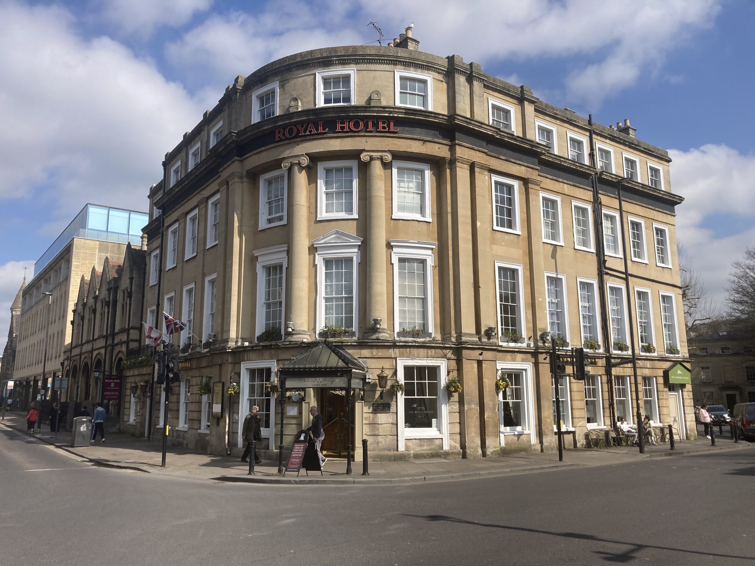
Just as you start to wonder how you will get into the city below you, the canal drops down a cascade of locks, one of which is the deepest lock in England, until the canal meets the Avon. You will stay at the Royal Hotel, not far from this junction and handy for some sightseeing. There is plenty to see but would suggest you prioritise the Abbey, the Royal Crescent and the Roman Baths.
Day 8 Bath to Keynsham 7.9 miles
From here on there is no more canal. The Avon is navigable through Bristol and to the estuary. But just because it’s the river that doesn’t mean there are no locks. There are a few all the way to Bristol, although there seem to be far fewer boats than on the canal proper.
The western side of Bath seems to last much longer than the approach from the east. It’s not until you reach Newbridge (now where have we heard that name before!) that we see open ground. Newbridge is home to a lovely pub, The Boathouse.
The walk continues along the river with tantalising views of the Bristol and Bath Railway Path where people seem to be travelling at a much faster pace than you. That’s because it’s a cycle path following a disused railway line. Don’t worry. You’ll get a taste in due course. Up on the hill to your right is Kelston Park, a magnificent 18th century Grade II-listed country house set in nearly 200 acres.
After 5 miles and just over half way you will be happy to reach Saltford. Two pubs, one at each end of the village, will provide a welcome lunch. In the centre of Saltford lies the brass mill. Now, we’ve seen mills producing flour and electricity through the power of water. But brass is a new one! The brass was made from Cornish ores and calamine from the Mendips. The mill is open every other Saturday.
At the end of Saltford we leave the river for only the second time to follow the aforementioned Bristol and Bath Railway Path which will take you safely across the canal for your final approach to Keynsham.
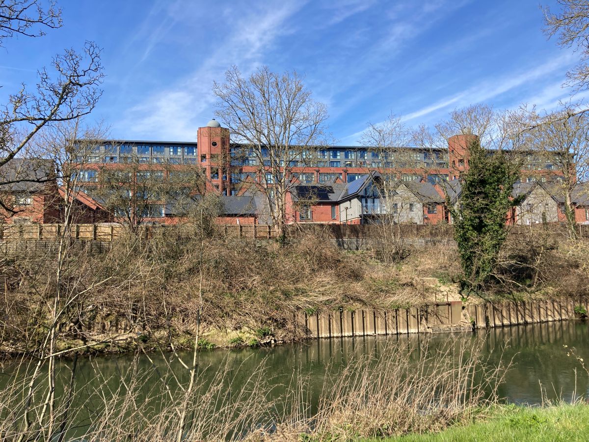
The most striking building in Keynsham is the enormous rectangular building you see in the distance. This was once the Elisabeth Fry chocolate factory, acquired by Cadbury and closed by Kraft. Elisabeth Fry was a quaker and philanthropist. Some of us still remember her cream chocolate which, we are told, still exists! The building is now an apartment complex. In Keynsham we’ve chosen the Old Manor House Hotel, believed to be the oldest building in Keynsham and serving guests since the 17th century through its 10 rooms.
Day 9 Keynsham to Bristol 10.3 miles
After a tricky start to the walk requiring a traverse of the lock gates you follow the right hand (north) side of the river through fields with the giant chocolate factory directly across the water. Soon you are at Hanham Lock with the chance of a mid-morning coffee at either of the two waterside pubs here.
From here until the outskirts of Bristol the canal snakes its way through a narrow gorge with steep wooded hills on either side and the occasional row of riverside cottages. Lunch can be obtained at Beeses, a popular venue across the river for which a ferry service operates.
Soon you are on the outskirts of Bristol, residential houses giving way to industrial units which take you to Netham Lock. We now leave the river as we follow the Feeder Canal to Temple Meads station from where the Floating Harbour commences.
The Floating Harbour was once the natural River Avon. But a channel was built south of the city and the Avon was diverted. The original river was then impounded from rising and falling tides. At the time of its creation in 1809 it was the largest area of impounded water in the world.
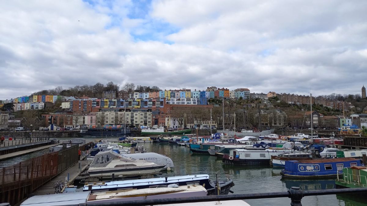
The Floating Harbour meanders through the centre of Bristol passing Castle Park and the magnificent Queen Square. The walk terminates at the end of St Augustine’s Reach, a basin dug out from the Floating Harbour and named after the nearby abbey which is now Bristol Cathedral. At the end of the basin is the Statue of Neptune, the official end of the walk.
You will be staying at the Harbour Hotel, in the centre of the city. But, before you check in, you might want to explore more of the Floating Harbour which continues for a further mile rejoining the Avon at Cumberland Basin from where the Clifton Suspension Bridge can be seen in the distance. Along the way you will pass Brunel’s SS Great Britain, at one time the largest passenger ship in the world.
Prices
Prices inclusive of bed and breakfast plus baggage transfer between hotels. A map and guide book is also included. You will have unlimited access to our local team in the event of difficulties.
Price per person assuming shared occupancy: £1,470
Price per person assuming single occupancy: £2,230
Rest days can be added but prices vary depending on category of hotel. Typically rest days are most likely to be in Bath
Standard Accommodation Option
This option follows exactly the same itinerary but uses accommodation that is of a slightly lower grade at the following locations:
Reading: 1843 (Bronze) instead of Malmaison (Gold)
Devizes: The Bear (Bronze) instead of The Peppermill (Silver)
Bradford on Avon: The Barge (Bronze) instead of Timbrell’s Yard (Gold)
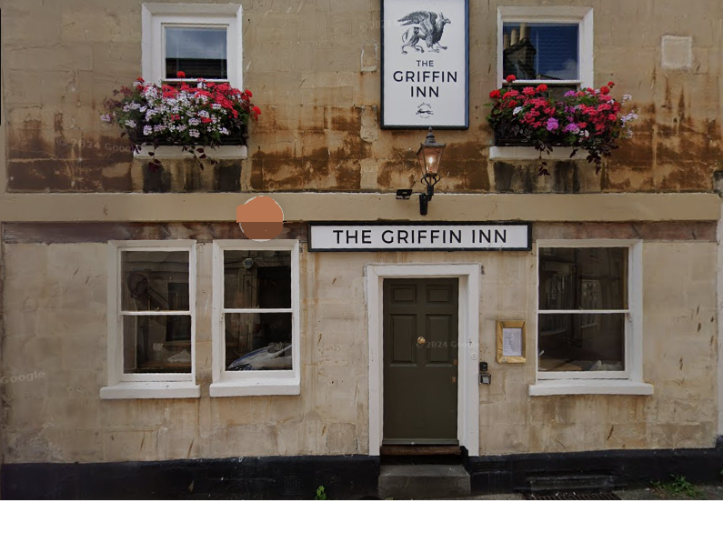
Bath: The Griffin (Silver) instead of Royal (Gold)
Bristol: Ibis, Bristol Central (Silver) instead of The Harbour Hotel (Gold)
Price per person assuming shared occupancy: £1,180
Price per person assuming single occupancy: £1,820
Check Availability
Ready to book?