Walk The Ridgeway
The Ridgeway National Trail (87 miles)
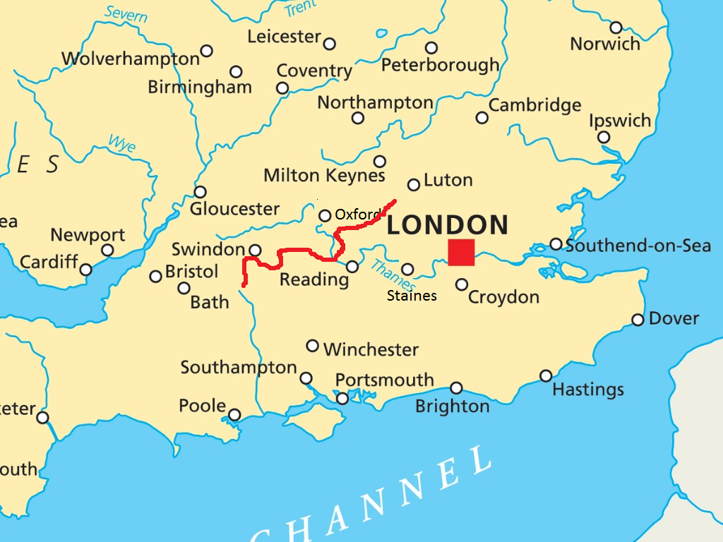
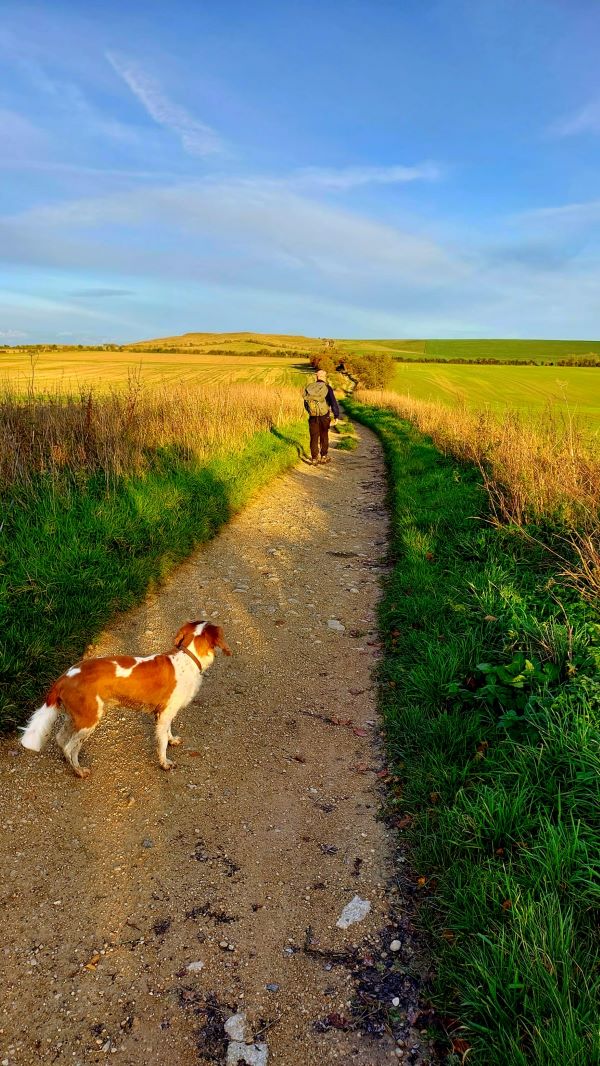
Described as “England’s oldest road”, The Ridgeway National Trail follows the line of the Berkshire Downs from Avebury in Wiltshire to the Goring Gap. For a few miles it follows the Thames to Wallingford before heading off through the Chilterns as far as Ivinghoe Beacon
What you should know
The Ridgeway uses parts of the Icknield Way, a pre-Roman trading route that connected Wiltshire to Norfolk. The Romans adopted this path and, along with Ermine, Watling and Fosse, it was one of the four highways of medieval England. The Icknield Way Path continues The Ridgeway as far as Thetford in Sussex.
Aside from a brief walk up the Thames, the route is following chalk escarpments all the way.
The trail is easy to follow. Although it follows a ridge, the elevation is quite low, and never above 1,000 feet. There are some short steep hills towards the eastern end.
The trail is spectacularly beautiful in spring and summer but can be grim in autumn and winter, unless you are lucky to catch a cold snap!
There are a number of points of interest along the way: the standing stones at Avebury is a World Heritage Site; further along is the remarkable White Horse of Uffington; and there are the remains of a number of bronze age hill-forts as well as burial chambers . The western section is peppered with racehorse training tracks, the trail passing close to Lambourn, the home of horse racing. On the eastern side through the Chilterns the trail passes through the grounds of Chequers, the country seat of the Prime Minister.


The trail can be divided into 3 sections:
Ridgeway west from Avebury to Goring: Here the trail follows the ridge of the Berkshire Downs from Overton Hill near Avebury dropping down to Goring some 40 miles later. Aside from Ogbourne St George, the path does not pass through any villages along this section. Instead you must drop down about a mile and 200 feet from the ridge to a number of villages off the trail: Bishopstone, Ashbury, Woolstone, Letcombe Regis and East Ilsley.
Goring to Mongewell, near Wallingford: At Goring, the trail heads north following the left bank of the Thames for 6 miles as far as Mongewell, just before Wallingford. The Thames Path follows the opposite bank and both routes can be followed for either trails – although the Ridgeway offers a far superior route.
Ridgeway east from Mongewell to Ivinghoe Beacon, near Tring: From Mongewell, the trail picks up Grim’s Ditch, an ancient earthwork, and heads north-east for a further 40 miles loosely following the Icknield Way. Towns and villages are passed through or close by including Nuffield, Watlington, Chinnor, Princes Risborough and Wendover. The trail passes through a number of nature reserves including Grangelands and Pulpit Hill, as well as passing through Chequers, the country home of the Prime Minister. The trail ends at Ivinghoe Beacon, close to Tring. Unlike the western section, much of the trail on the eastern section avoids the high ground although there are some steep hills between Chinnor and Princes Risborough. The section is full of variety: up and down hills, through fields, meadows and woods, and in and out of towns and villages.
Travel and Accommodation
Getting to the start
The Ridgeway officially starts at Overton Hill, on the A4 between East and West Kennet in Wiltshire, north of Marlborough and south-west of Swindon. It is quite an inaccessible spot. However, The Ridgeway can be reached directly from Avebury or via our recommended detour which takes in the henge of Avebury, Silbury Hill, the long barrow (burial mound) of East Kennet and the Sanctuary. This adds a further 3.5 miles.
There is a range of accommodation in Avebury which can be reached by bus or taxi from Swindon station,
Getting from the end
There is no road at Ivinghoe Beacon so, even if taking a car, you will still have some further walking to do. The good news is that the area around Ivinghoe Beacon is well served by public transport, being in one of the commuting “home counties” of Buckinghamshire. The nearest train station is Tring which has frequent trains into London. The nearest accommodation is at Aldbury, 3.5 miles from Ivinghoe Beacon, not far from Tring station.
Accommodation
Compared with the Thames Path, there is much less choice of accommodation. Although we have developed some suggested itineraries, walkers will have to accept some days may be longer than others. Another factor is that, due to the topography of the walk, the accommodation is often around a mile away; and 200 feet lower. Towns and villages are found along the “spring line”, where underground chalk streams finally emerge on reaching more impervious rock. Be prepared for an uncomfortable uphill walk each morning!
Other Resources
Here are a couple of links to sites that offer further help:
The Ridgeway National Trail official website
Rambling Man provides a fun, free and easy to read account of many long distance walks including The Ridgeway National Trail
Maps and guidebooks can be purchased from our online shop